
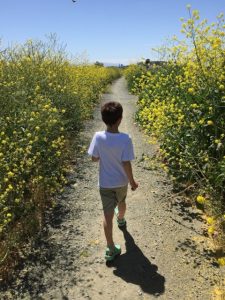
Summer is quickly approaching, and warmer weather is within our reach. With schools wrapping up in the next few weeks, why not plan some outdoor adventures to take advantage of the longer days ahead. In the months ahead, we'll be featuring more posts on discovering and making use of the trails and nature features in and around San José.
Why Go Outside?
Kids are naturally drawn to the outdoors. They use every single part of their bodies when playing outside. There are rocks to climb, dirt and sand to explore, and new friends to be made along the way. Outdoor play can be one of the best nature-made classrooms for children, helping them develop a variety of skills that they can use throughout their lives. Not only are children given the chance to explore the environment around them, they can also develop their muscle strength, hand-eye coordination, and gain self-confidence as they test their limits and boundaries in unstructured play outdoors.
When playing outdoors, children are introduced to different concepts in math and science that can only be found in nature. Whether its learning how to read a trail map, figuring out distance in miles, or learning about the texture of the dirt and rocks that makes up the trail, children learn best through doing. Being outdoors is a place full of sensory experiences that will help strength a child's connection to their world.
Things to Remember
When exploring the outdoors with your child, these tips will help ease the transition from indoor to outdoor fun.
- Be flexible and have fun: Hiking with kids is more about the journey than the destination. You may not even leave the parking lot on your first try, but give your child a chance to stop and smell the flowers, follow the squirrel to really make the experience a memorable one for them.
- Review Safety & Hiking Rules: Before starting your hike, talk to your child about staying safe on the trails. Remind them of what plants to avoid (like poison oak), leaving plants and rocks where they are for others to enjoy and not straying away from the trail.
- Snacks and Drinks: Be prepared with plenty of snacks and fluids for rest stops along the way. Although children have boundless energy, they'll need to refuel more frequently outdoors.
- Start Small then Add On: Introduce your child to hiking through short trails (1 mile or so) in familiar settings. Later, add on little by little (either distance or time spent walking) as they get used to the pace of a hike.
- Play Games & Have Fun: The best way to encourage a child to love an activity is to make it fun! Count the number of birds you see flying overhead, play a game of I Spy as you walk down the trail. Turn the uphill climb into an adventure with a dragon to battle and to scare away.
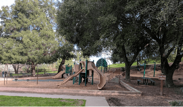
Early Literacy in Everyday Places: The Park
Not all nature play has to be done at a park or hiking trail. You can incorporate elements of nature into your everyday routines this summer:
- See: Talk about the trees, the plants and the animals and insects you see at the park. Walk down a path with your eyes closed, then again with them open. How is it different?
- Hear: Close your eyes and listen to the sound around you. What do you hear? Who or what is making noise? The other children, cars, birds, etc. Try to mimic the sounds that you hear around you.
- Touch: What is the different between sand and tanbark? Make marks in the sand using a stick or twig. Make piles out of the tanbark.
- Smell: Smell the trees, flowers and grass. What memories do the smells bring up for you?
Books to Share
Before you start exploring, prepare your child about what awaits with a few books about nature, hiking and the fun of being outdoors.


Add a comment to: Take a Hike (with the Kids)